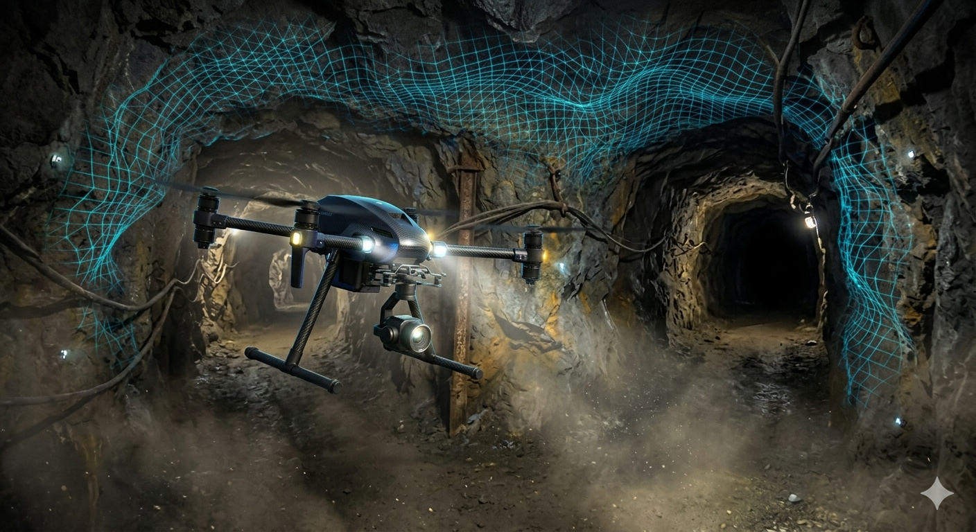
Autonomous mapping in GPS-denied terrain is becoming critical for mining operations, dense forests, industrial interiors, and underground inspection. In these environments, drones must localize, map, and return safely without relying on satellite navigation.
Why GPS-Denied Mapping Matters
Traditional aerial workflows fail when GPS is jammed, blocked, or unreliable. Autonomous drones equipped with onboard perception can still generate high-quality maps for planning, hazard analysis, and security operations. This keeps mission continuity even in harsh and infrastructure-poor settings.
Core Navigation Stack
Modern systems combine visual-inertial odometry, LiDAR SLAM, and IMU fusion to estimate pose in real time. Instead of depending on external signals, the drone continuously builds a local understanding of geometry and motion. This allows stable flight through tunnels, canyons, warehouses, and enclosed plants.
Real-Time 3D Mapping Pipeline
As the drone flies, sensor streams are fused into dense point clouds and occupancy grids. The system updates maps incrementally, enabling live path replanning and obstacle avoidance. Teams can monitor mission progress, identify blind zones, and trigger targeted re-scans before landing.
Autonomy and Safety Controls
GPS-denied autonomy requires robust fail-safe logic: geofencing by map boundaries, battery-aware return behavior, redundancy for perception dropouts, and collision envelopes tuned to confined spaces. These controls reduce risk while keeping flights productive in complex terrain.
Operational Impact
Organizations using autonomous mapping drones in GPS-denied zones report faster site digitization, lower manual survey risk, and better decision-making from up-to-date spatial data. The biggest win is consistency: repeatable map quality even where conventional navigation cannot operate.
As onboard AI and edge compute continue to improve, GPS-denied mapping will shift from specialized capability to standard practice across industrial and security workflows.